WHAT WE DO.
Precision. Performance. Proven Expertise.
At ACCESS Group, we deliver engineering support solutions built on measurable results and technical excellence. We specialise in Construction Materials Testing, Geotechnical Investigations, and High-Precision Surveying — providing end-to-end support for Namibia’s most demanding infrastructure, mining, and civil engineering projects.
Our services are delivered through dedicated divisions, each staffed by experienced technicians, engineers, and field specialists. All work is conducted using modern equipment, calibrated instruments, and methodologies aligned to recognised regional and international standards.
We Power Namibia’s Infrastructure .
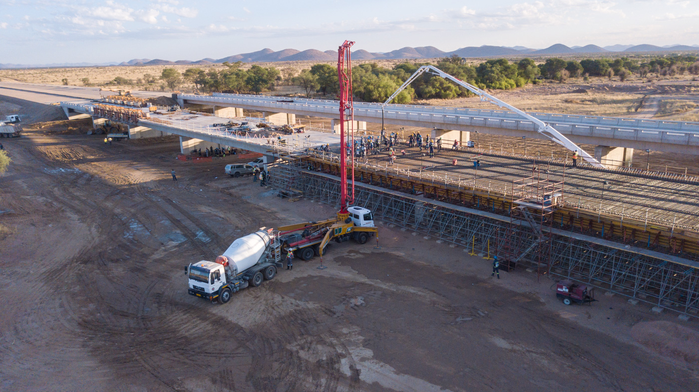
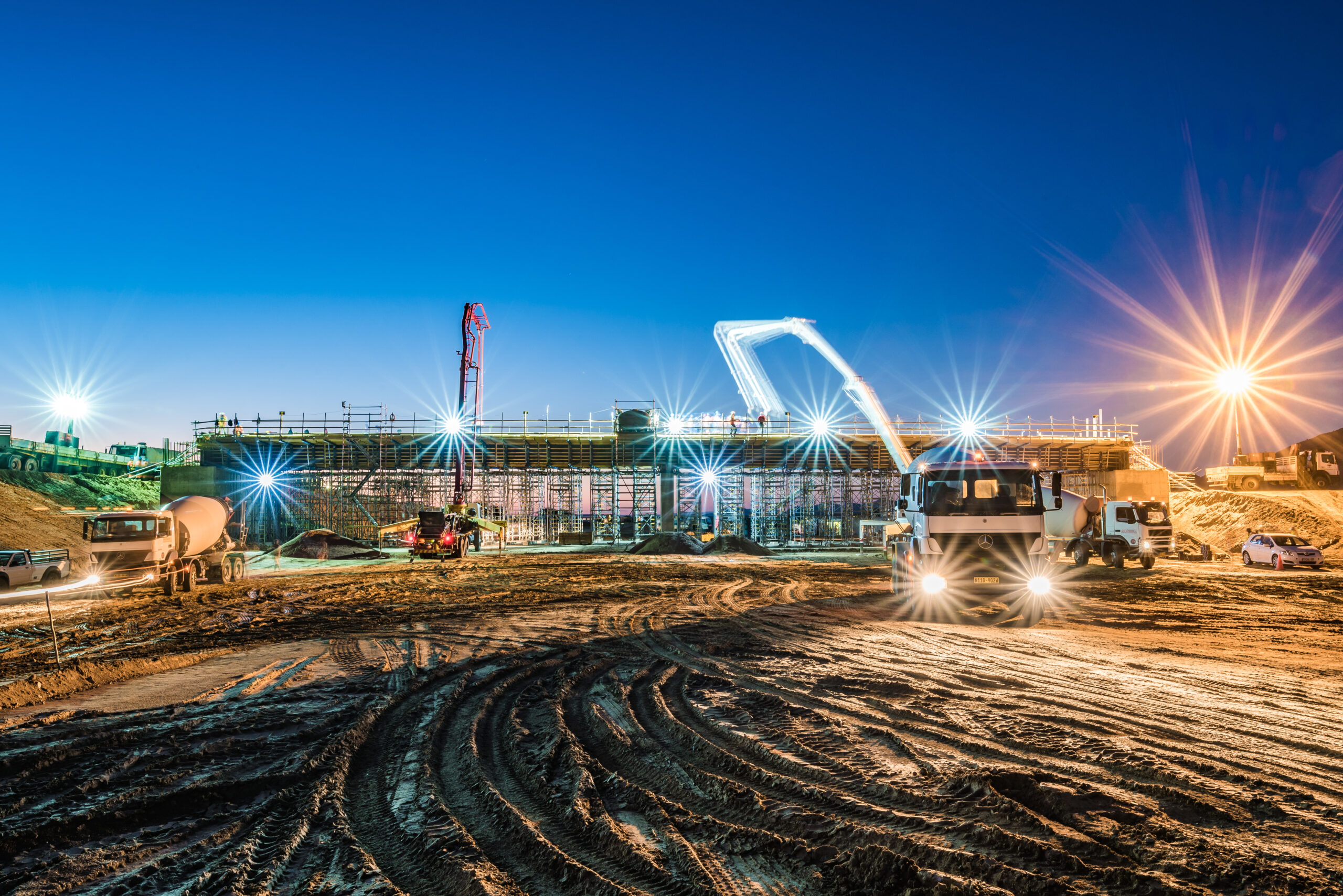
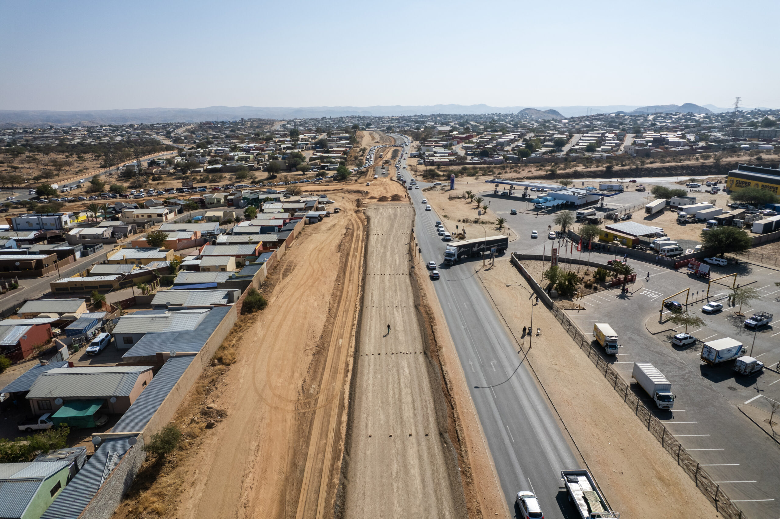
From mining operations to roads, pipelines, and construction sites, ACCESS Group provides certified testing, expert surveying, and geotechnical solutions across Namibia — all in line with recognised industry standards.
LABORATORY SERVICES.
Construction Materials Testing | On-Site & In-Lab
Our in-house laboratories provide comprehensive testing of construction materials to verify their compliance with design specifications, national regulations, and international standards. Whether you’re breaking ground on a new development or verifying quality on an active site, our lab ensures the materials you’re working with are reliable, strong, and ready for the job.
We test a wide range of materials — including soil, concrete, aggregates, bricks, and asphalt — to evaluate their composition, durability, and performance characteristics. From quick-turnaround concrete cube tests to complex road layer investigations, our team works efficiently to give you the data you need, when you need it.
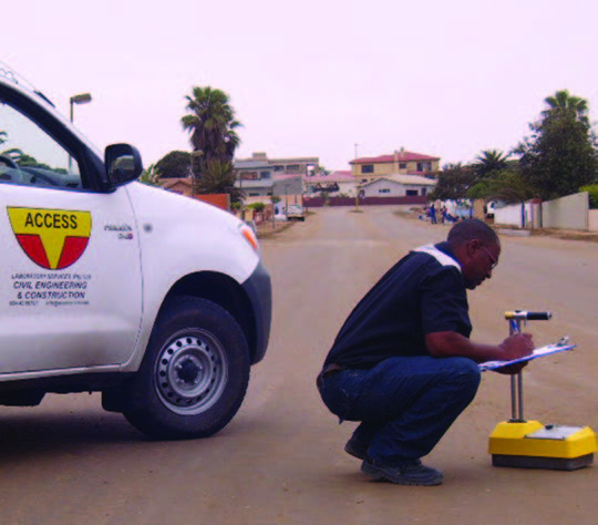
Our services are not limited to lab work. We also deploy mobile field testing teams who can assess compaction and moisture levels directly on site, reducing delays and improving accuracy. Every test we conduct is followed by a formal report, clearly laid out for contractors, engineers, and project managers.
As part of our commitment to supporting Namibia’s growth, we assist companies in setting up internal QA/QC systems, including technician secondments and on-site lab stations. Our testing services have been trusted on roads, government projects, mines, airports, and commercial developments across the country.
GEOTECHNICAL SERVICES.
Foundation-Ready Ground Investigations
Good design starts with reliable data. Our geotechnical division helps clients understand what’s beneath the surface — ensuring that every structural, road, or civil engineering decision is informed by reliable site information.
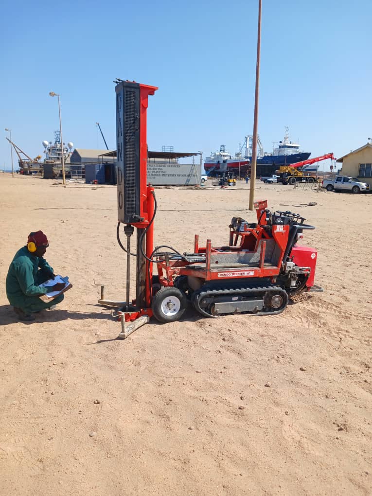
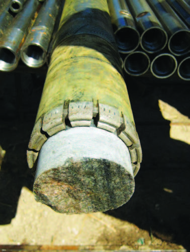
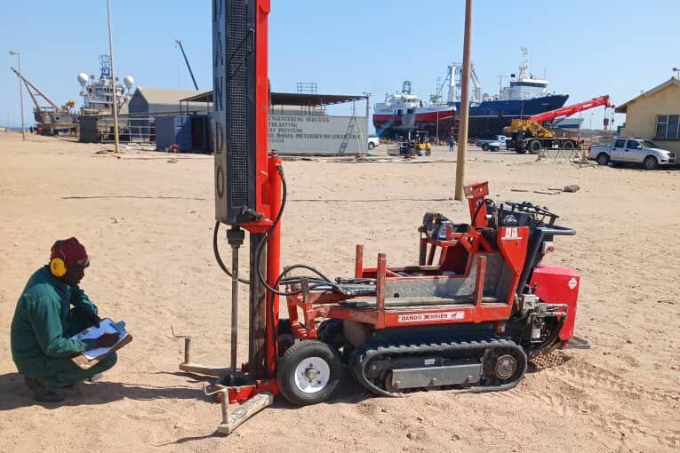
We conduct detailed investigations to assess founding condition which include, SPT testing, DPSH Testing, Drive Sampling, Diamond Rotary Core Drilling and Auger Sampling. Bearing capacity and subsurface conditions are evaluated. Using borehole drilling, cone penetration testing, and laboratory analysis, we build a clear picture of how the ground will respond to construction. This allows engineers to make informed choices on foundation design, retaining systems, slope stability, and more.
Our reports are practical, not just technical. We translate field data into useful insights, recommending foundation types, expected settlement, and any mitigation needed for weak or expansive soils. Whether you’re building in the dunes of the coast, or rocky interior terrain — we’ve worked there, and we know what to look out for.
We also support geotechnical compliance for EIA submissions, infrastructure feasibility studies, and pavement design — including compaction analysis and moisture profiling. Every report is quality checked and aligned with recognised international practices to ensure your design team receives clear and actionable input.
SURVEY SERVICES.
Engineering Surveys, Construction Set-Outs & Drone Mapping
Our survey team provides precise spatial data for every phase of your project. Using a combination of GNSS, total stations, drones, and CAD software, we capture and translate the physical landscape into usable engineering information.
We assist from the very beginning — providing topographic surveys for design, layout services for construction, and as-built documentation for completion and compliance. Every measurement is captured using calibrated equipment and processed with industry-standard software, ensuring accuracy down to the millimeter.
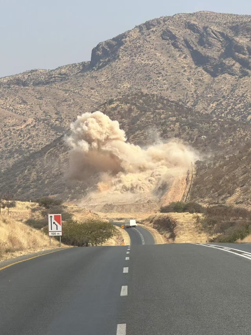
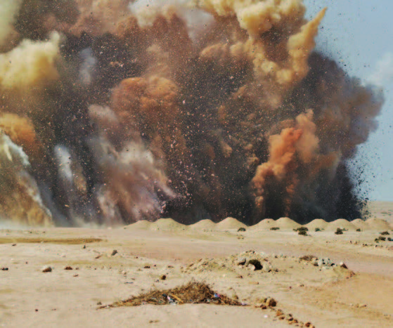
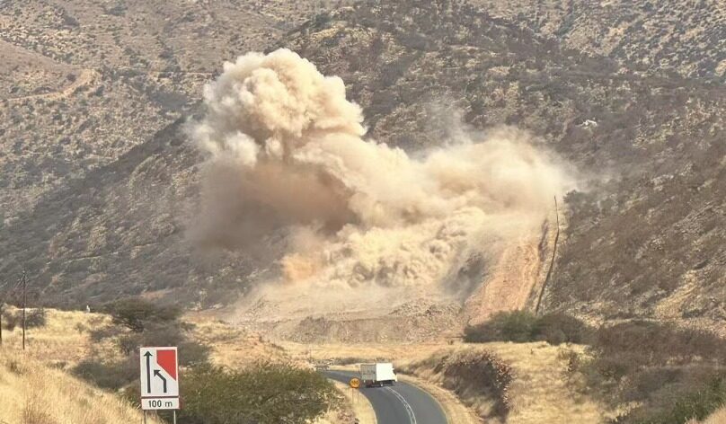
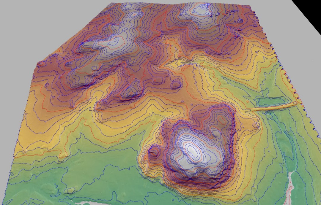
Through UAV (drone) technology, we’re able to provide high-resolution maps, orthophotos, and 3D models of large sites quickly and safely. This is especially valuable in mining, roadworks, and hard-to-access environments. For mining clients, we also offer blasting grid layouts, pit surveys, and volume calculations for material extraction tracking.
Beyond the big builds, we provide ongoing monitoring for structural movement — tracking cracks, shifts, and tilts in critical infrastructure. Our reports support early intervention before failures occur, protecting both structures and the people around them.
No matter the project scale, we work fast, we work clean, and we deliver clear, engineer-ready data. When timelines are tight and precision matters, our team becomes your most trusted site partner.